1. Conservation Parcel Prioritization Model
Project Overview:
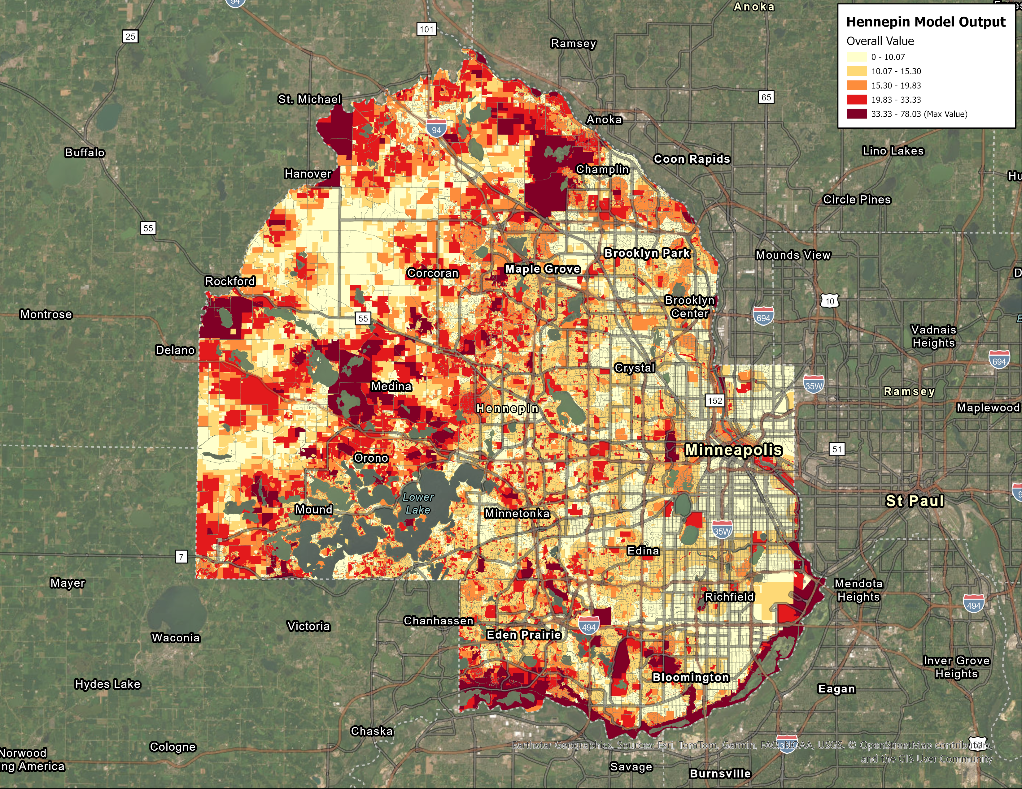
Developed a comprehensive geospatial suitability model to prioritize land parcels for conservation efforts in Hennepin County, Minnesota. The model analyzes multiple environmental and spatial criteria to score and rank parcels based on their conservation value.
Technical Implementation:
- Language: Python
- Key Libraries: Pandas, GeoPandas, Shapely, NumPy, Matplotlib, Seaborn, SciPy, Scikit-learn
- Data Sources: Protected Areas, Natural Spaces, Minnesota Biological Survey (MBS), Minnesota Land Cover Classification System (MLCCS), Wildlife Action Network, Important Bird Areas, Bee Habitat, Risk of Development layers, Water Resources (Shoreland Buffers, Floodplains, Wetlands, Headwaters, Groundwater data)
Model Components:
- Spatial Context (30% weight): Distance to Protected Areas, Distance to Natural Spaces, Potential Easement Analysis
- Habitat Quality and Diversity (25% weight): Quality Ranking based on MBS and MLCCS data, Quality Community identification, Habitat Diversity assessment
- Size (15% weight): Relative and Absolute Size scoring
- Wildlife and Plant Conservation (15% weight): Wildlife Action Network rankings, Bird Habitat, Pollinator Habitat
- Risk of Conservation (10% weight): Risk of Development scoring
- Water Resources (5% weight): Shoreland Buffer analysis, Floodplain presence, Wetlands coverage, Headwater area identification, Groundwater Recharge potential, Groundwater Contamination susceptibility
Key Achievements:
- Successfully automated complex multi-criteria spatial analysis
- Streamlined data processing workflow for efficient execution
- Provided actionable rankings for conservation decision-making
- Used SciPy and Scikit-learn for statistical validation of model results